In today’s feature I’m going to take you on a White Mountains motorcycle ride.We left off in the previous post at The Kitzhof Inn in the town of West Dover; nestled in The Green Mountains of Vermont.Our destination today is The Town and Country Inn located in Gorham, New Hampshire.Once again, I’ll be traveling in the saddle of my BMW F800GT sport touring bike.
A Little Background On Some Big Mountains
The White Mountains cover about 25% of the entire land area of the state of New Hampshire.They are part of the Appalachian Mountain System which extends in a north-south orientation across the eastern and northeast United States.
The highest peak in The White Mountains is Mount Washington at 6,288 feet.This is the highest mountain peak in the northeastern United States.Mount Washington holds the record for the strongest-ever recorded wind gust in the world at 231 MPH!More on this later.
Taking Those Roads Less Traveled…Again
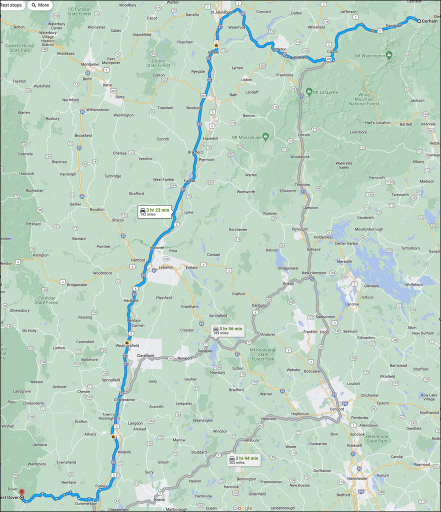
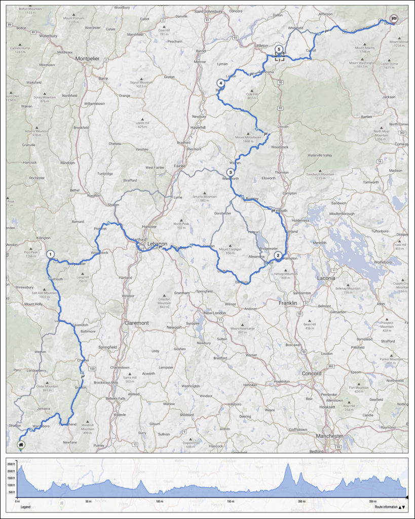
I didn’t ride 400 miles from my home on the US Interstate system to get here, and I certainly don’t plan on hitting “the slab” today either.No…today will once again be all about riding rural, scenic, lightly-traveled back roads.Once again I will utilize the best motorcycle navigation resource available: Kurviger.I have written about the Kurviger app in a previous post.If you’re not yet familiar with it you’ll want to check that out.They say a picture is worth a thousand words.Therefore, I’ll offer up two that clearly display the beauty of this navigational resource designed by motorcyclists for motorcyclists.
This version of today’s route was generated by Google Maps.In predictable fashion Google created a short, swift course of 192 miles that could be covered in less than 3-1/2 hours.It included a long stretch of Interstate 91 (and most certainly passed by as many of their paid advertisers as possible).
This incredible route was created by Kurviger.It covers 273 miles of fantastic twisty, scenic, back roads that will take more than 8 hours to traverse.Note the graph at the base of the map.Not only does Kurviger show you the curvy route you’ll follow on the journey, but also the incredible elevation changes you’ll experience along the way.
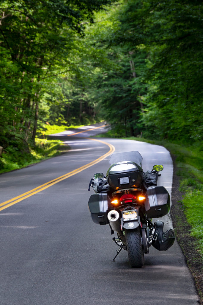
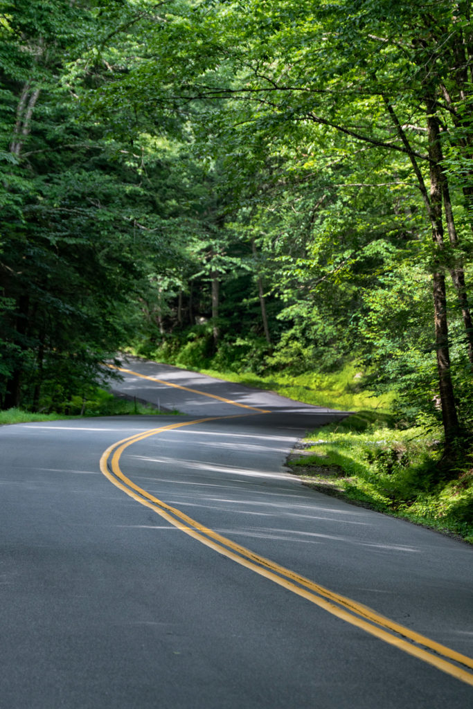
Leaving West Dover, VT I find myself on wonderful rural roads surrounding Glebe Mountain and Salt Ash Mountain.The roads are beautifully-paved and technically challenging.I travel for miles on end without encountering another vehicle on these remote roads.Most of the roads are not numbered routes.They bear local names only.
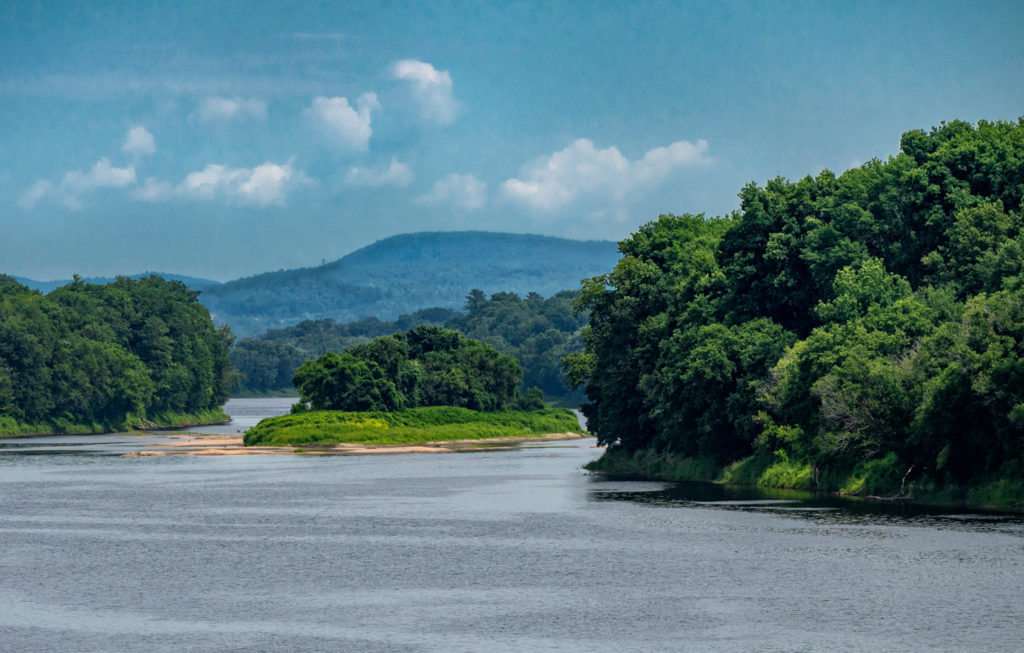
The roads were so sparsely-traveled that I thought nothing of stopping the bike right on the tarmac to take a photograph.After a few pleasant hours behind the bars I cross The Connecticut River which runs all the way along the Vermont-New Hampshire border to its origin at Lake Francis near the Canadian border.
The Connecticut River serves as nature’s natural boundary between the states of Vermont and New Hampshire
Because It’s There
The White Mountains are home to some famous tourist destinations.For instance, Mount Washington is a popular stop.I have made the exciting ride to the summit of Mt. Washington in the past.However I will not be doing so on this trip.Much like The Tail of the Dragon in The Great Smoky Mountains, riding the Mt. Washington Auto Road is one of those “bucket list” type rides.You’ll do it once to say you’ve done it.However you probably won’t do it a second time.
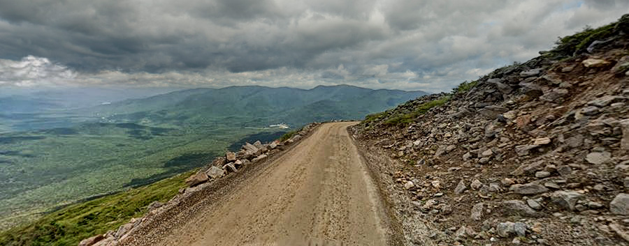
The Mount Washington Auto Road is a thrilling ride to be sure.Surprisingly it is a privately-owned road.The current fee for a motorcycle and rider on this toll road is $25.The entire 7-1/2 mile length is fully-paved these days. (When I rode it, there was an unpaved, gravel section about a mile in length…definitely the scariest part of both the climb and the descent).
The formerly unpaved sector of the Mt. Washington Auto Road
There are no guard rails on the road, it is fairly narrow and you’ll be looking off some very steep drop offs…especially on the way up when you’re in the outer lane.There are several pull-offs along the road where you can stop to take pictures.Pay attention to nothing but your riding when you’re rolling.This is not a road for a novice motorcyclist!Be sure your skill set is up to this challenge.
View from one of the scenic overlooks along the Mt. Washington Auto Road.Photo courtesy of Joseph Notovitz
Incidentally, for those not up to the riding challenge, a 2 hour guided tour is available.In addition a shuttle service for hikers who want to be transported up or down the mountain is available.There is also a professional driver service available for automobile operators who reach the summit but don’t care to take on the even more challenging descent.On two wheels you’re on your own.
Watch The Weather
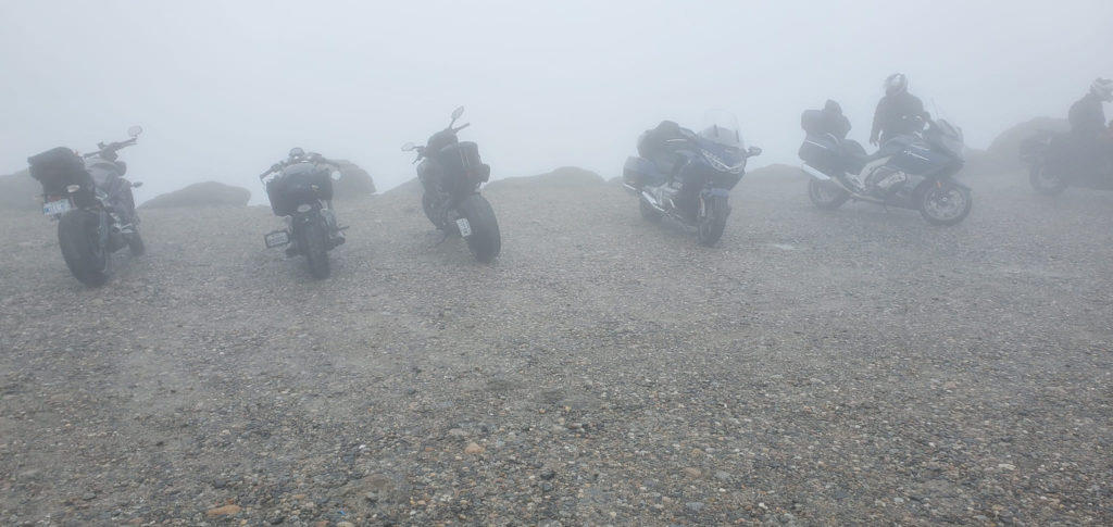
Your reward for reaching the summit is a spectacular view of the entire White Mountain range and beyond.Well, maybe.You see the weather on Mt. Washington is unpredictable at best.For instance, you can leave the base (approximately 2,000 feet above sea level) under perfectly clear skies.By the time you reach the 6,000+ foot high summit you might find yourself in dense fog.This happened to a group of riders from the Long Island BMW Riders Club on a recent Mt. Washington climb.
Members of the Long Island BMW Riders Club enjoying the view (Not!) from the summit of Mt. Washington.Photo courtesy of Joseph Notovitz
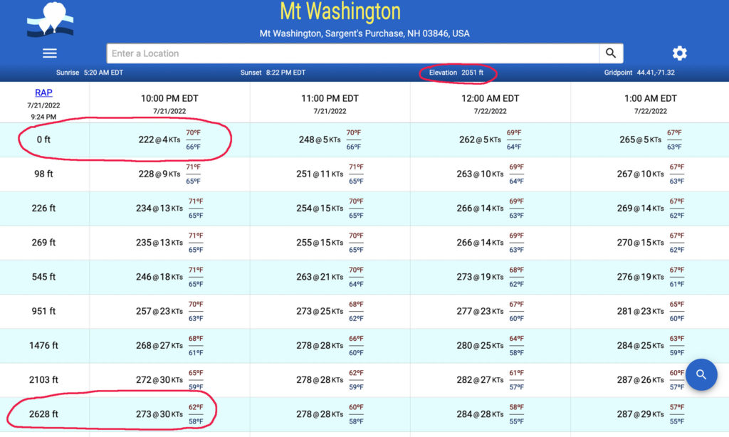
Similarly, you’re very likely to encounter unnerving winds and wind gusts on the mountain.As an FAA licensed UAS (Drone) pilot, I’ll often look at wind speed charts when planning certain challenges.It’s one of the weather resources I use when planning rides all around the country.
In this chart you can see that the wind speed at the base of Mt. Washington was a mere 4 knots; but at 4,800 feet (well before the summit) it had already increased to 30 knots!Be prepared for this phenomenon.
Legendary Byways
Another popular White Mountain attraction for two wheelers is NH Route 112 which runs 56 miles in an east-west orientation.The route runs through the heart of The White Mountains National Forest connecting the cities of Bath and Conway.
The 34 mile stretch of NH Route 112 between the cities of Lincoln and Conway is known as The Kancamagus Highway.No White Mountains motorcycle ride would be complete without a pass on “The Kanc”.This is an incredibly scenic byway which runs (heading east) alongside the east branch of the Pemigewasset River; then the Hancock Branch. The route steadily ascends, over the first 13 miles, through a series of hairpin turns until it crosses the Kancamagus Pass at 2,855 feet of elevation.It then descends along the Swift River in the Saco River watershed for the last 21 miles.
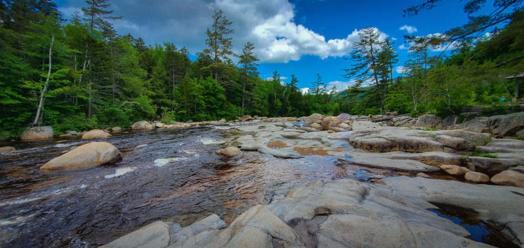
A stream by the side of The Kancamgus Highway.Photo courtesy of Joseph Notovitz
The road is a relatively easy one to navigate on two wheels.Heck…the first time I took it on I was in the saddle of a Harley-Davidson Softail® with a lowered suspension, a springer front end and 20” ape-hanger handlebars! In addition, that was nearly 30 years ago when my motorcycling skills weren’t nearly what they are today.If I could survive it on that machine, you’ll have no problem on yours today.
The road is an absolute delight…at times.In addition to being popular with motorcyclists; tourists in all manners of transportation can, and do, clog the road.If you really want to enjoy a pass on “The Kanc” do it as early in the day as possible; while the rest of the tourists are sipping their cappuccinos in the upscale village of Lincoln.
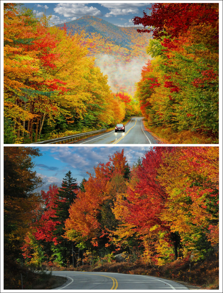
The Kancamagus Highway is breathtaking when the fall foliage explodes
The road is also one of the most popular destinations on the east coast for “leaf peepers”….those folks who come out to watch Mother Nature put on her annual spectacular display of fall foliage.Avoid The Kancamagus Highway on peak foliage weekends in the fall.Traffic will be bumper-to-bumper, moving at a snail’s pace, from end to end.
Back Roads And Beauty Abound
My White Mountains motorcycle ride today was not about visiting these mainstream tourist attractions.Today I’m all about the riding.My route has taken me along challenging, twisty, curvy mountain roads.In addition I’ve “told” Kurviger to route me to some particularly scenic spots discovered by other motorcyclists on their past rides.
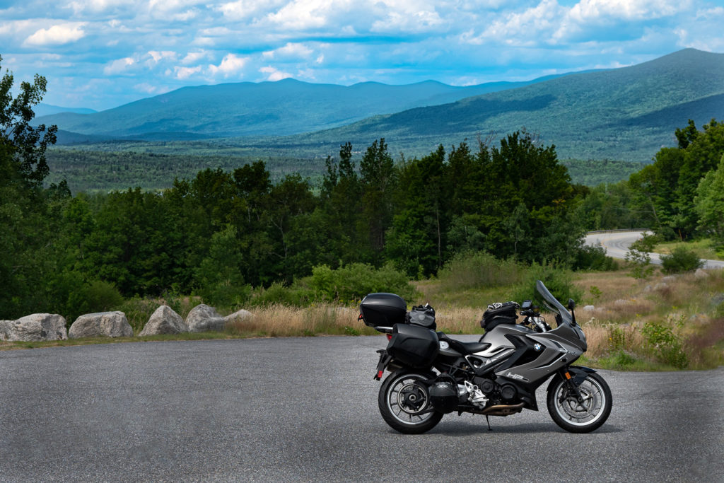
A remote back road in The White Mountains near Bath, NH
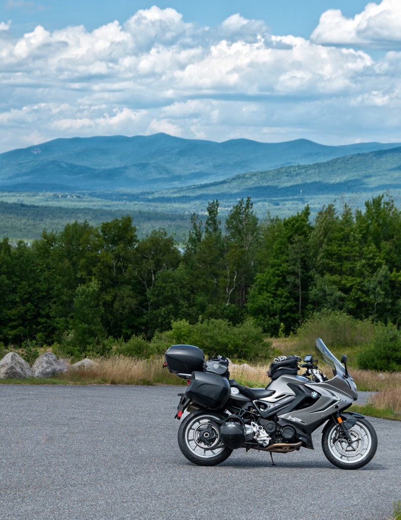
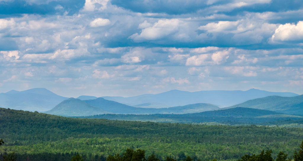
The White Mountains in the background at an overlook near Carroll, NH
Stay The Night
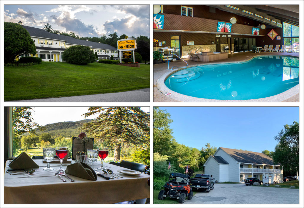
Our lodging for the night was provided by The Town and Country Inn and Resort in Gorham, NH.This is an extremely Moto-friendly venue.In addition to the 50+ bikers in our Backroads Magazine group, there were dozens of trailers loaded with ATVs and UTVs taking advantage of New Hampshire State’s 1,400 miles of off road trails.
The inn offers well-appointed, comfortable rooms and a dining room that overlooks a golf course with a White Mountains backdrop.The cocktail lounge was a popular spot at the end of the day’s riding.Similarly the indoor pool got a lot of use.
A real bonus for me, as an aerial photographer, was the ability to launch my drone from the expansive rear parking area.This panoramic view of The White Mountains was captured right outside my motel room door!
All Good Things Must Come To An End
Sunday morning we gathered for the inn’s bountiful breakfast buffet and discussed our riding plans for the day.I had been looking at my favorite weather forecasting tools and deduced that severe storms would be all over New England within 24 hours.Not just widespread intermittent showers, but serious amounts of heavy rain…all day…from New Hampshire to New Jersey.
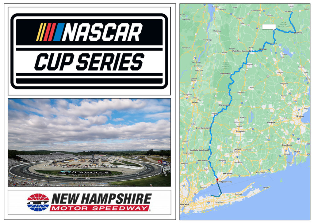
I made the decision to check out a day early and ride back to Long Island on this beautiful sunny day.The NASCAR Cup Series race was taking place about 100 miles due south of Gorham.I planned an interesting route heading south and west to avoid the traffic congestion that would certainly surround New Hampshire Motor Speedway.
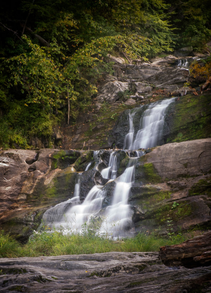
Somewhere in Massachusetts the temperature reading on the BMW’s dashboard hit 95 degrees.I was stopping every 40-50 miles to throw down yet another 16 ounce bottle of water, thereby staying hydrated on the 400+ mile burn back home.I made a quick stop at Kent Falls State Park on Rt 7 in Kent, CT for the one solitary photograph I took all day.Incidentally, Connecticut Route 7, north of New Milford is another wonderful motorcycling road.
The main falls at Kent Falls State Park
Monday Morning Quarterback? Hardly.
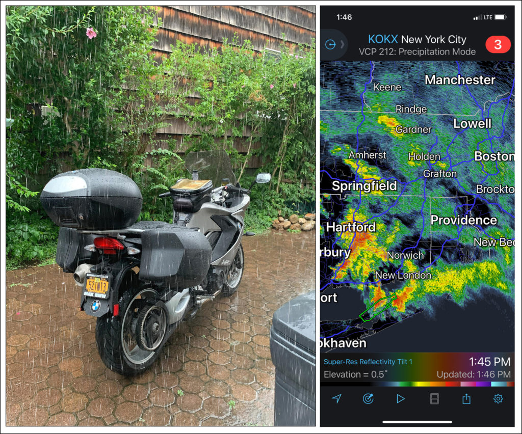
My White Mountains motorcycle ride has drawn to a close.Back at home on Long Island I was awakened at 6:30AM by a huge clap of thunder.The storms I predicted yesterday were arriving.In addition to dumping huge amounts of rain on MY roof, the tempest was raging ALL over New England.I felt sorry for my brothers and sisters who chose to spend another day up in New Hampshire.It would be a long, wet ride out of the region today.On a positive note I intentionally left my bike outside last night.1,000+ miles of accumulated road grime was being washed away courtesy of Mother Nature.
Conclusion
As always we welcome your comments below regarding this White Mountains motorcycle ride feature.Be sure to subscribe to Roadcraft USA to receive updates when new features hit the blog.Rubber side down, Folks.Be safe always.
Click Here to view an interactive visual index page where you can quickly browse through all of the great features that are published on the Roadcraft USA blog.