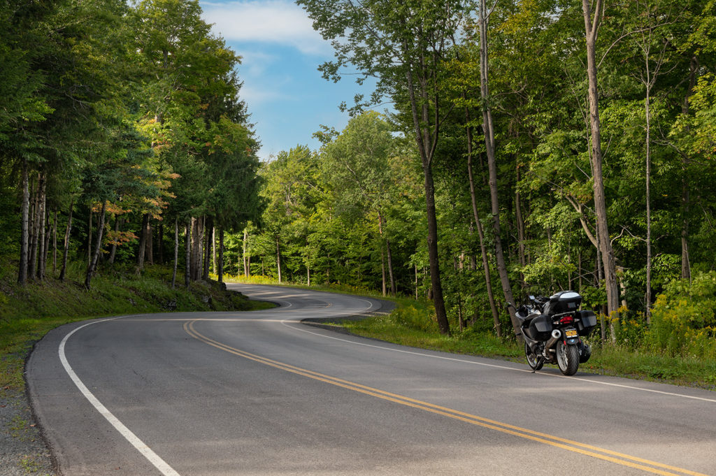
I just returned from a great little road trip which included a stretch of The Mason-Dixon Line in north central Maryland. Along the way I had posted some photos and updates on my Facebook pages. I was overwhelmed with responses inquiring about my favorite motorcycle trip planning app. After answering a staggering number of individual inquiries I decided to write this post that I can simply send folks a link to.
The US Interstate Highway System
The U.S. federal government first funded roadways through the Federal Aid Road Act of 1916 in an effort to construct a national road grid. It really came into its own in the 1950’s with the passage of the Federal Aid Highway Act of 1956. The interstate system is designed around two major considerations. First: National Defense. The system is designed for the mobility of military troops to and from airports, seaports, rail terminals, and other military bases. In addition, Public Safety. The system is designed to facilitate evacuations in the event of hurricanes and other natural disasters.
The Interstate Highway System’s development saw a decline in the railroad system for passengers and freight. The trucking industry expanded dramatically. The cost of shipping and travel fell sharply. Moving to suburban areas became possible. The rapid growth of widespread, more automobile-dependent housing became available beyond central cities.
Far from the interstate on a wonderful motorcycle route through southeast Ohio
The Boredom Factor
For all of its benefits no one will deny that “riding the slab” (traveling the interstates) is a real downer. They all look exactly the same…by design. They must meet certain criteria. Controlled access. Maximum grade. Minimum number of lanes. Shoulder width. Median width. Vertical clearance. In conclusion: countless other regulatory requirements.
I stated this about interstate travel in my book Road Work: Images and Insights of a Modern Day Explorer. “Between the endless lines of tractor trailers, thousands of billboards and road signs, tall retaining walls and noise barriers; plus the necessity of constantly monitoring the traffic ahead of you, beside you and in your rear view mirrors; it may be quite possible these days to travel cross country, coast-to-coast, and not see a single thing!”
The Way I Roll
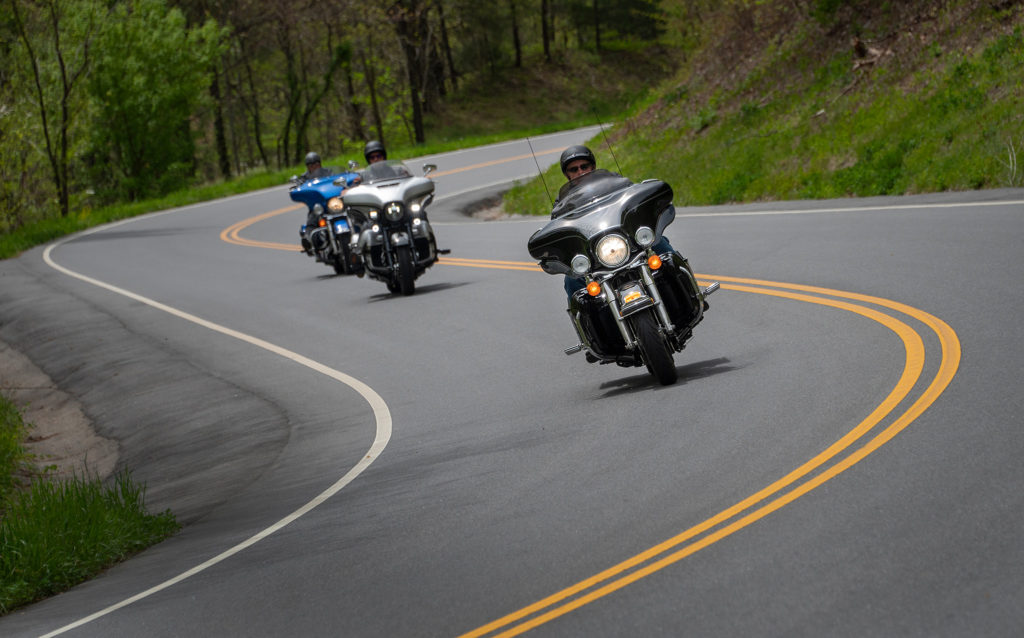
In four decades of riding I’ve logged far too many miles at high speeds. Traversing long distances on interstate highways and other major thoroughfares. I totally understand the necessity for this. Sometimes you only have a short window of time in which to enjoy your pursuit of motorcycling. The responsibilities of your career and family obligations often limit the time you can spend away from home. I get it.
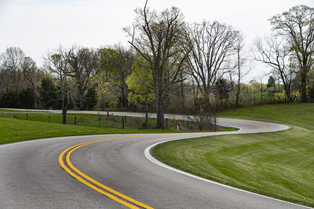
A great motorcycling road in The Foothills of Eastern Tennessee
I don’t roll that way any longer. I ride for quality, not quantity these days. There are simply no quality experiences on the interstate system. None. Nowadays I travel on the roads less traveled. My enjoyment of the two-wheeled experience has reached a whole new level.
The Imperfection Of Technology
Incredible advances have been made in the area of navigation. I’ve been a “paper maps and compass” kind of guy for the better part of my life in the saddle. I’ve gotta’ admit: todays navigational aids are nothing short of miraculous to the serious two-wheeled traveler. Yes…even this old school vagabond has a GPS unit on his bike.
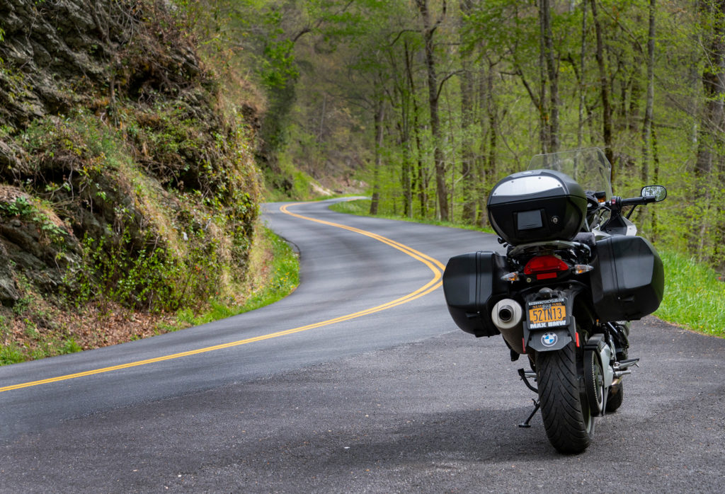
A true “Road Less Traveled” suggested by Kurviger on a ride through Kentucky
The advent of GPS navigators and smartphone navigational apps are slowly rendering paper maps all but obsolete. Even the printed offerings from the pillar of travel planning, The AAA, have become less detailed. Therefore they are less useful. Most travelers these days seem to only be interested in getting to their destinations as quickly as possible.
Some great navigational apps have emerged over the years. Google Maps and WAZE are probably the two most popular. I won’t deny their effectiveness in terms of avoiding traffic congestion and encounters with speed enforcement officers. Just understand that the developers of these apps are bound to one major objective. To get you from point A to point B in the fastest and/or shortest way possible. After that, promoting as many of their paid advertisers that are located along the way.
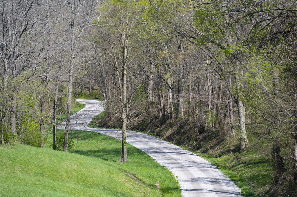
Pulled over to take in the scenic view along this route
I don’t know about you, but to me it’s not about the destination, it’s about the ride! I’ve found that most motorcyclists subscribe to that philosophy as well. I want to travel on scenic byways laced with challenging curves and exciting elevation changes. Where motorcycle-related services might be found and quality fuel can be sourced. Places where bikers are eagerly welcomed to dine and lodge.
The Best Motorcycle Trip Planning App
Thanks to an adventure rider friend of mine I have discovered a wonderful bridge between technology and tradition. It’s found in a free online resource at Kurviger.de. Kurviger is a route planning tool for motorcyclists, by motorcyclists. It has proven to be an invaluable asset for explorers like myself.
Simply put it allows a traveler to set a start point and end point for any journey. In addition you enter preferences for the type of roads you wish to ride upon (Main roads, secondary roads, twisty curvy routes, unpaved roads, etc). Within seconds Kurviger generates a route for you based upon the past experiences of tens of thousands of like-minded riders.
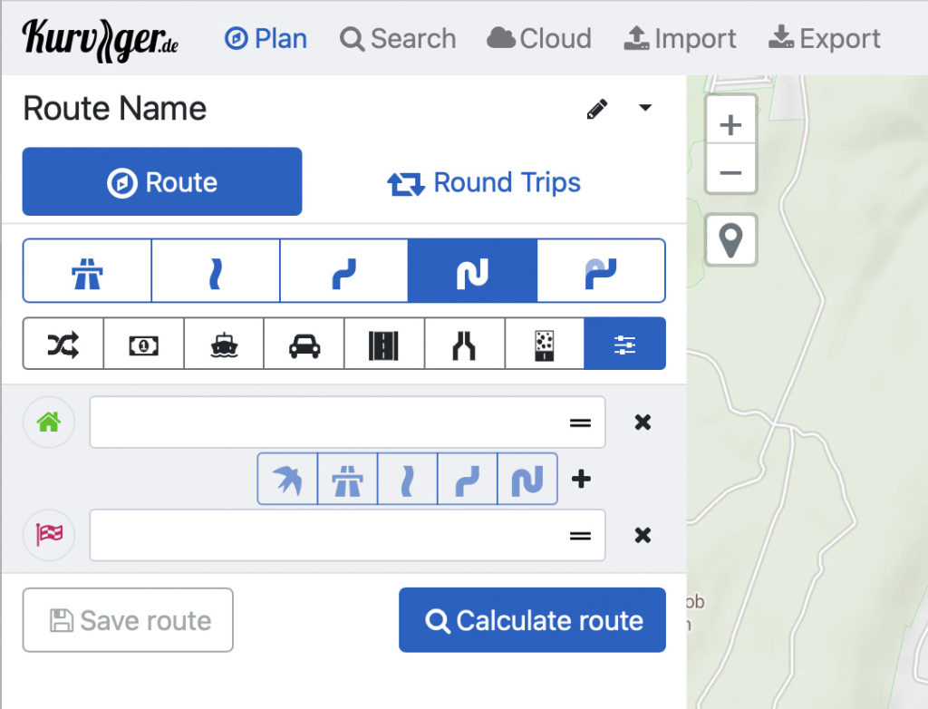
The simple Kurviger interface to choose the type of roads you wish to ride upon
Customizable
The route can then be modified to include attractions such as scenic overlooks, eateries, gas stations and motorcycle-related services along, or close to, the designed route. The route can be exported as a .GPX file and imported into any conventional GPS unit. For instance the Garmin BMW Motorrad® unit on my machine.
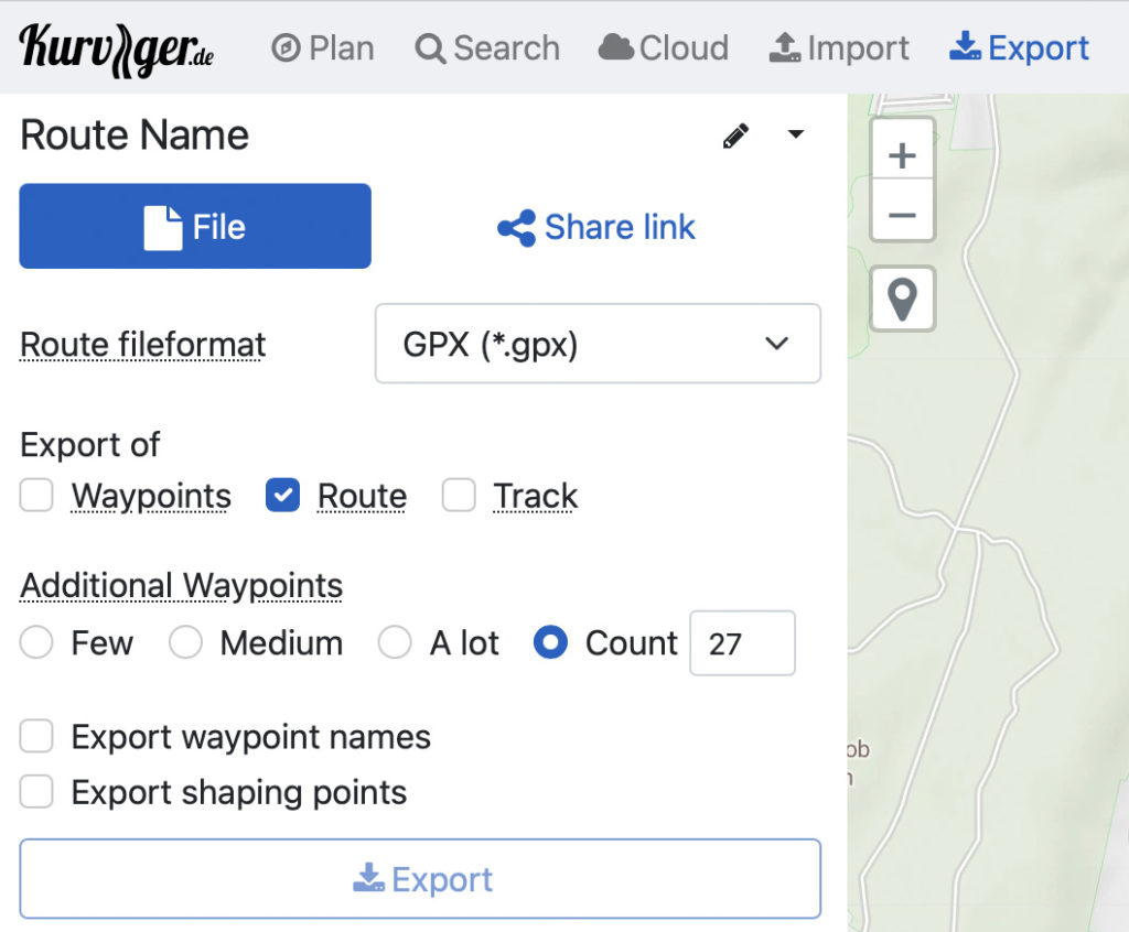
The Kurviger Export dialog box to send the designed route to your GPS unit
The basic Kurviger features can be accessed free. I opted for their more comprehensive “Tourer” version which currently costs $10 per year. That investment has been returned 100 times over already with travels on incredible roads. Roads that I never would have discovered with a conventional GPS, any navigational app or even with the most detailed paper maps. I can’t even begin to tell you about all of the wonderful riding experiences I’ve had thanks to Kurviger.
Disclaimer
I wish to point out that I receive no compensation for spouting about Kurviger. I just consider it to be the best motorcycle trip planning app out there. In other words I simply want to share this great resource with other like-minded riders. Truth-be-told, the app does have some limitations and I’ll address them shortly.
How I Use The Kurviger Resource
I do not use the Kurviger mobile app. I use the desktop version which can be found at www.kurviger.de. Kurviger is based in Germany; thus the “.de” suffix instead of the usual “.com” variety. I design my routes on the computer desktop. The screen “real estate” allows one to really see the big picture of what your route is going to look like
As a writer and digital photographer I always travel with a 13” MacBook Pro laptop computer. I can plan my next day’s ride right in my hotel room. At home I have the luxury of planning my routes on a huge 32” computer monitor! I can’t imagine trying to plan anything other than the simplest, shortest ride on a smartphone screen.
The Drawbacks of Kurviger
1. For those that want to use Kurviger as a mobile app, the main drawback is that it is available for Android devices only. That’s right. No iPhone/IOS app is available as of now.
There is a workaround for iPhone users. You can plan your route(s) on the desktop portal as I do. After that you can export the route(s) to the “Scenic” app which is available for your iPhone/IOS devices. I personally have not done this, but I understand it works seamlessly.
2. I have twice encountered errors in my Kurviger routes. I honestly can’t tell you if they were Kurviger errors, Garmin GPS errors or a combination of both. My GPS is an “older” unit (5 years) which can only contain 30 waypoints in any given route. I tell Kurviger to limit the number of waypoints to 29. This avoids having the GPS unit break the whole route up into multiple, smaller segments. Twice my Kurviger routes have stopped navigating correctly on my Garmin GPS. As a result I was forced to abandon them. Bummer.
The Kurviger app knows the kind of roads motorcyclists like
Other than these two occurrences the Kurviger app has performed flawlessly. It has put me on the kinds of roads I want to ride. The roads that you will never find using Google Maps, WAZE or even the latest hard copy paper maps. I have passed by some of these roads so many times in the past. I am so thankful that I get to regularly ride roads of this caliber these days.
The Choice Is Yours
The two photos below show exactly what I’m talking about. The first photo shows the Google Maps suggestion of taking I-87 (The New York State Thruway) to I-84 to I-81 to go from Nanuet, NY to Binghampton, NY. The second photo shows the Kurviger-planned route through twisty, curvy, rural upstate New York landscape.
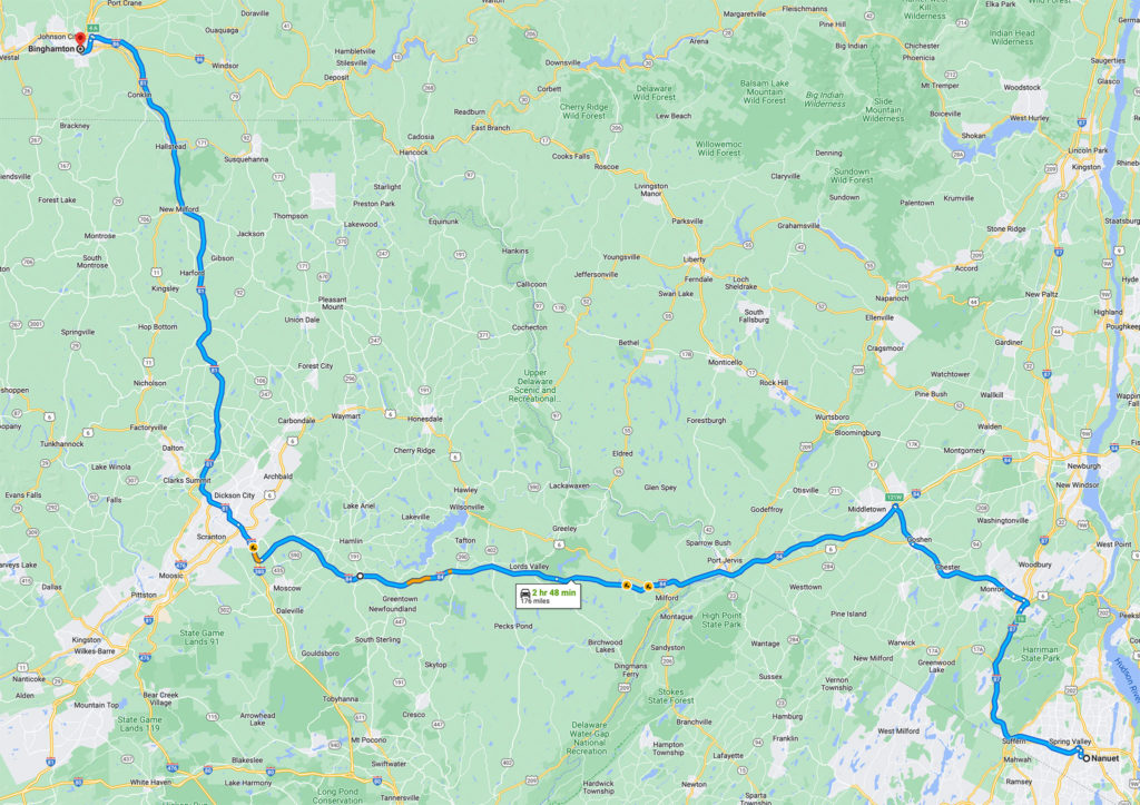
A boring Google Maps route using three Interstate highways
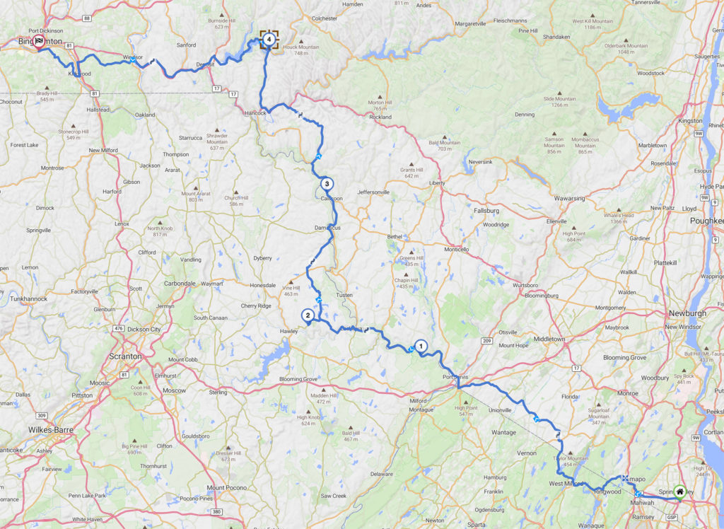
The Kurviger route: “By Motorcyclists, For Motorcyclists”
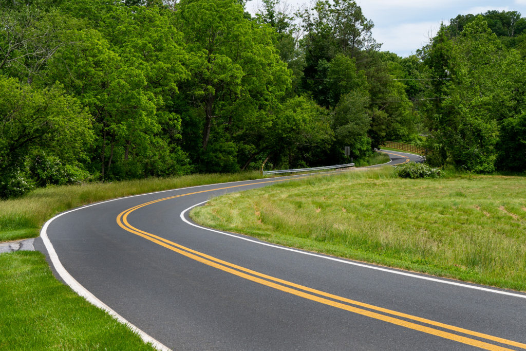
In this second set of photos below you can see that Google Maps suggested I take US 30 to I-83 to I-70 to quickly get from the Amish Country in Pennsylvania to Frederick, MD. In the second photo you see the exciting Kurviger-generated route through southern Pennsylvania and northern Maryland.
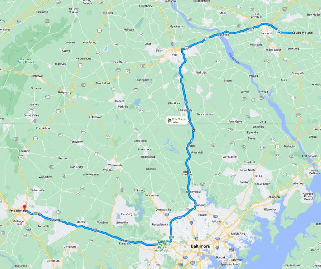
A boring interstate route from Pennsylvania to Maryland
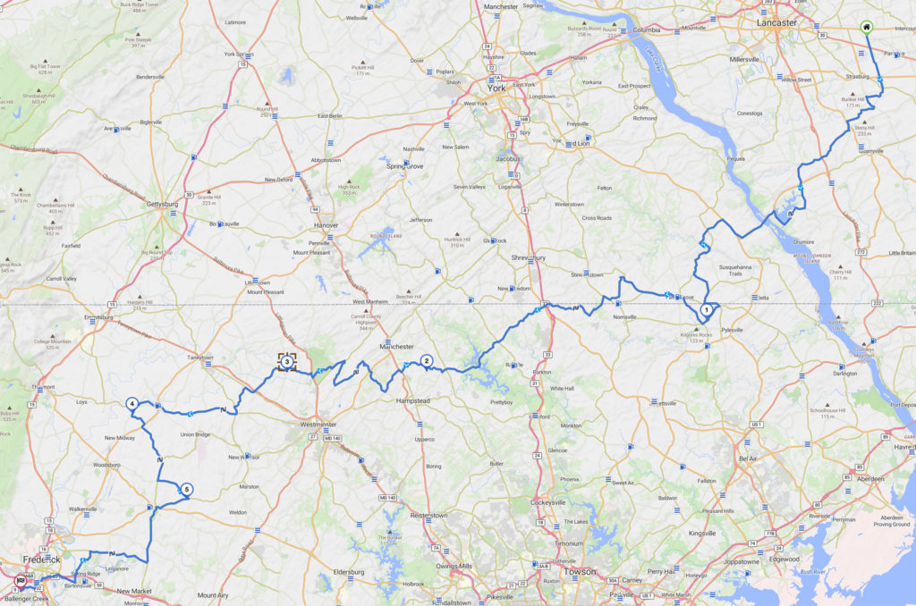
The brilliant route generated by Kurviger for the same trip!
I don’t know about you, but I’d much rather ride the exciting, scenic routes that are laid out in the Kurviger route planning resource. Remember this is an app by motorcyclists, for motorcyclists.
Top Reasons For Not Using A Smartphone
Those who know me know that I am not a fan of riders who use smartphones on their motorcycles. In online forums it drives me crazy when I see riders complaining about distracted automobile drivers one minute. Then asking about the best smartphone apps for riding in the their next post. In the spirit of the old David Letterman show I have compiled the following top seven list regarding motorcycle smartphone use.
#7
Your smartphone relies on being connected to good cellular service or WiFi to use navigation. If you’re a serious adventurer you will certainly find yourself in remote areas where strong cellular signal or WiFi are not available. Your smartphone navigation app is useless at this point. Yes, I know you can plan your route ahead of time and store the route on the phone. Therefore it doesn’t require signal to continue navigating. But if you have to make a change to your route, you’re sunk!
#6
Your smartphone phone is not waterproof. I understand that there are some riders that only go out on two wheels in fair weather. So be it. No judgement. But if you’re a serious rider, sooner or later you will find yourself riding in the rain. Yes, there are smartphone cases that claim to be waterproof. Those cases often preclude you from accessing all of the phone’s tactile controls.
#5
Your smartphone is not weatherproof. Beyond rain serious riders will often encounter temperature extremes. I’ve ridden in 100+ degree temperatures where the readings close to the pavement exceed that number by a lot. I’ve also ridden in freezing temperatures with wind chills far below freezing. Your smartphone is not designed to handle these temperature extremes. Its functionality will be compromised in extreme temperature. In some cases, it may shut down completely to prevent damage.
#4
You can’t properly interact with your smartphone’s touch screen while wearing gloves. This impediment requires that you pull over and remove your gloves to use the touch screen interface. A dedicated motorcycle GPS, like my Garmin/BMW Motorrad Unit, works flawlessly even when wearing my heavyweight, heated winter riding gloves. Shame on you if you’re not wearing protective gloves; or if you’re removing them and putting them back on while you’re riding.
#3
Your smartphone can be easily damaged when attached to your motorcycle. It doesn’t matter how tough you think your phone is, or what the mount’s manufacturer claims. It was never designed to handle the constant vibration and sharp impacts it will be subject to on your handlebars. In particular the optical image stabilization in your smartphone’s camera will very likely be damaged if you use it on your bike.
#2
Another quote from my book: “I have philosophical issues with riders being “connected” when on a bike. It never ceases to amaze me seeing how attached some riders are to their phones. Whether on group rides with folks I know, or even watching total strangers pull into in highway rest stops; the first thing these riders do, before they even dismount, is check their phones for emails, messages, or whatever other “urgent” communication they might have missed over the past few miles.
For the love of God, leave that baggage at home! One of the reasons I ride is to escape from the pressures of everyday life. As a stress reliever it has no equal (aside from maybe the, er, reproductive act). The last thing I need when I’m “in the zone” is to receive alerts about the latest celebrity Instagram post or a calls about my expiring car warranty. Put your phones away and luxuriate in the ride! Motorcycling might be the ultimate collaboration between man and machine. Attack it. It is the most intimate mode of travel in which to take in both the enormous beauty and the most subtle nuances of nature. Savor it”.
#1
And finally…this simple, common sense, safety suggestion. If just one motorcyclist benefits from this warning it will have been worth everyone I’ve pissed off with this smartphone tirade. I am not wishing any bad luck to any of my two wheeling brothers or sisters. But if you ever find yourself “separated” from your motorcycle, and need to summon emergency help, you want your phone to be in your pocket. You want it on your person. Not attached to the handlebars of your bike.
Carving up the twisties with a little guidance from Kurviger
Conclusion
We hope you have enjoyed this post and hope you get to give the Kurviger app a chance on your next outing. You’re gonna love it! We’ll be adding a “sequel” in the future outlining some of the finer points of using Kurviger. We’d love to hear what your favorite route planning resources are. Leave a comment below. Be sure to subscribe to Roadcraft USA for breaking news and special offers. Ride safe and ride better, everyone!
Bravo, bravo, bravo!!!!!
Your dumbphone rant alone made the article worthwhile. I’m a true GPS fan and actually have two mounted while touring. One for map display navigation and the other set for digital display (time to next turn, distance to turn, Speed, etc).
What a great setup, Steve. I find myself toggling between those two displays all the time. It must be great to have both of them in front of you at the same time.
Heh…for #1 there: I crashed in April. If my phone was on my handlebars, I would have been screwed. The phone would have not survived and calling for a tow would have been…interesting.
So sorry to hear about the crash, Andy. Glad to hear your phone was where it belonged.
This is great information and I appreciate what you have out together for biking enthusiasts. I struggle with planning so I’m really looking forward to using this website.
Thank you, Laura. I hope you find our features useful and that they help you enjoy your two-wheeled adventures more fully.
Michael that was well written and very Interesting take on This Subject. I’m so glad someone wrote about navigation . I’m very confident you will have opened a lot of eyes. Great Job as usual.
Frank Mirando
Thanks, Brother. More to follow. Be safe on the trip north this week. See you when you get back.
I’m that guy that maps it all out in an atlas and makes notes that I keep in my pocket before the trip…. I used the GPS unit that came with my 2012 HD one time… and left it in a cheap hotel in Marion, IL… and went back to the old way of life. But I’m seriously considering joining the 21st century and investing in a new GPS unit. It sounds as if, for 10 measly bucks a year, Kurviger can’t be beat… I’m taking your advice…. thank you for the detailed explanation!
Best ten bucks I spend every year, Mark. Puts you on great riding roads that I never would have found otherwise.
Love this article, and the pictures also! The routes I planned in New Hampshire last weekend with Kurviger were stellar! Some of the most curvy, scenic, and technical roads I have ever seen.
Kurviger never ceases to amaze me, Joseph. In the interest of full disclosure I will point out that YOU are “…the adventure rider friend of mine…” that introduced me to this fantastic resource. I’m sure it served you well in The White Mountains.
Pingback: Hudson River road trip - Roadcraft USA
Pingback: arizona slot canyon photos - Roadcraft USA
Pingback: foothills parkway motorcycle trip - Roadcraft USA
I like kurviger, but my fav is MRA Route Planner with my Route uploaded to my Garmin. I also subscribe to REVER to use as a reference because it has Butler maps embedded.
I’ve heard great things about Rever. Haven’t used it personally yet, but I’m going to give it a try. MRA Route Planner is a new one on me. I’ll have to check it out. Thanks for chiming in, Mark.
BTW, love what you wrote in this article!
A few more thoughts:
1. I have found MRA Route Planner to be the most robust of the lot and it can handle 200 waypoints and has other good utilities I don’t think the others have. If there is something better out there, I’m all ears. I subscribe to Kurgiver, Roadtripper and Rever as references to find the great roads, but I map it on MRA and export the route (multiple export options by type of GPS – like Garmin-specific and BMW Nav, etc.) into my Zumo XT (It fits in my nav slot with an adapter on my K1600).
2. I applaud your views on not using your phone as a GPS. I keep it in my pocket, but Bluetooth it along with my Sena into my Zumo so I can play music and GPS directions in my helmet. I don’t answer calls unless its from my wife. I’m out there to ride, not blab on the phone.
3. I have the route in my GPS, but no more planning once I leave my driveway. Too many times I have pre-planned hotel stays only to cancel and lose the night’s cost. I just find something on Priceline about mid-way through the day for that night. Same with campgrounds.
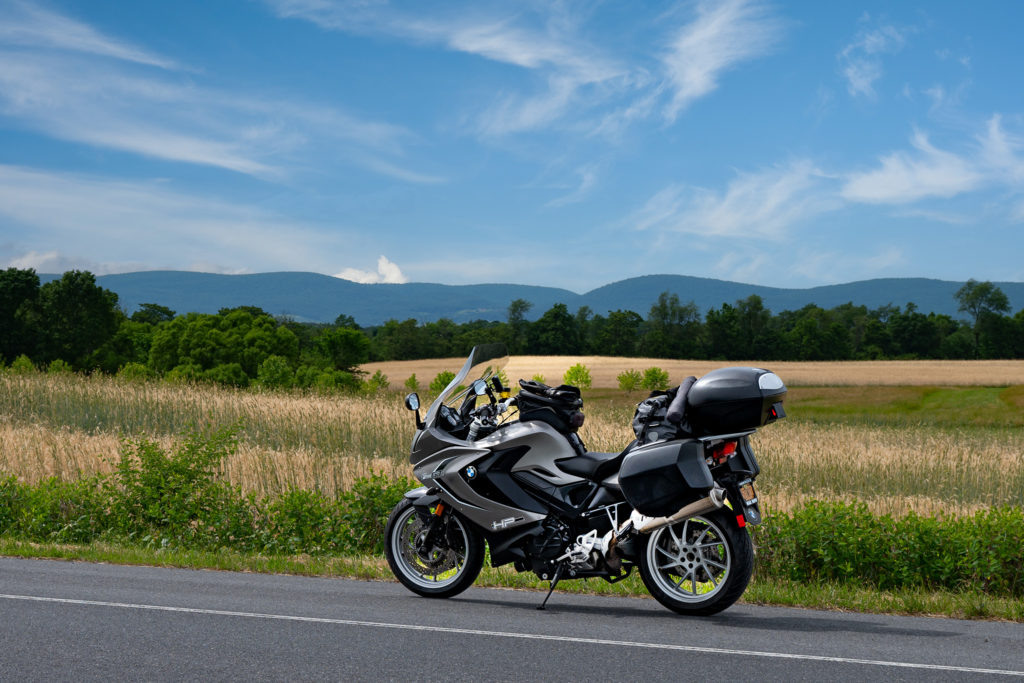
Thanks for the great introduction to a new-to-me app. I bounce between Scenic and Rever—I wish I could blend the features of them together. Perhaps off topic, but can you tell me the brand & size of your windscreen and tail pack? I have the same bike and am shopping for both.
Thanks for commenting, Richard. The Kurviger app works seamlessly with Scenic. You can design your routes on the desktop and export them to Scenic for use on your smartphone on your bike. A lot of riders do that as Kurviger does not offer an iPhone native mobile app. My windshield is the Puig Touring Windscreen for the F800GT. It is amazing. Cuts through the wind beautifully and I stay dry, even in torrential rain. I originally bought the clear model but replaced it later with the light grey tint offering. The top case on the back of the bike is the factory BMW case. The waterproof roll bag is the Firstgear Torrent bag (which is reviewed elsewhere on this site. Just use the search icon to find the review.