In the previous post I described day #1 of my June 2023 motorcycle road trip revolving around the Mason-Dixon Line between Pennsylvania and Maryland.As day #2 gets underway the Canadian wildfire smoke continues to affect the Mid-Atlantic states.
I spent last night in Frederick, Maryland in the home of a dear friend, so I can’t offer any lodging recommendations to folks planning on staying in that area.Finding a place for travelers to rest their heads is no problem, however.Frederick, with a population of 85,000 people, is the second largest city in Maryland, and is home to dozens of Motels and Hotels accommodating anyone’s budgetary or amenity concerns. (It therefore has its share of traffic congestion nightmares…particularly around times of commuter rush hours).
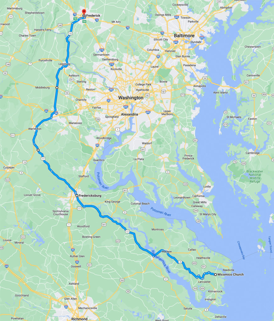
Charting Today’s Course
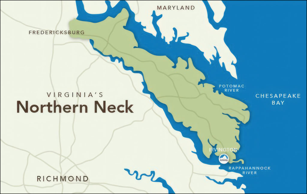
Today was set aside to be a nice, leisurely riding day.My destination would be the tiny little hamlet of Wicomico Church, Virginia; about 180 miles away.Don’t blink or you’’ll miss it.It is located out in the Chesapeake Bay region on The Northern Neck of Virginia.
I would be taking secondary roads…Route 15 South out of Frederick to Route 17 East near Bealeton, Virginia.From there I would follow Route 17 all the way east, out on to The Northern Neck of Virginia.This route was chosen for two reasons:
1.I wanted to make good time on the road…leaving plenty of time to explore The Northern Neck of Virginia in the afternoon and evening hours.
2.I didn’t want to go anywhere near the traffic horror story that surrounds our nation’s capitol in Washington, DC.
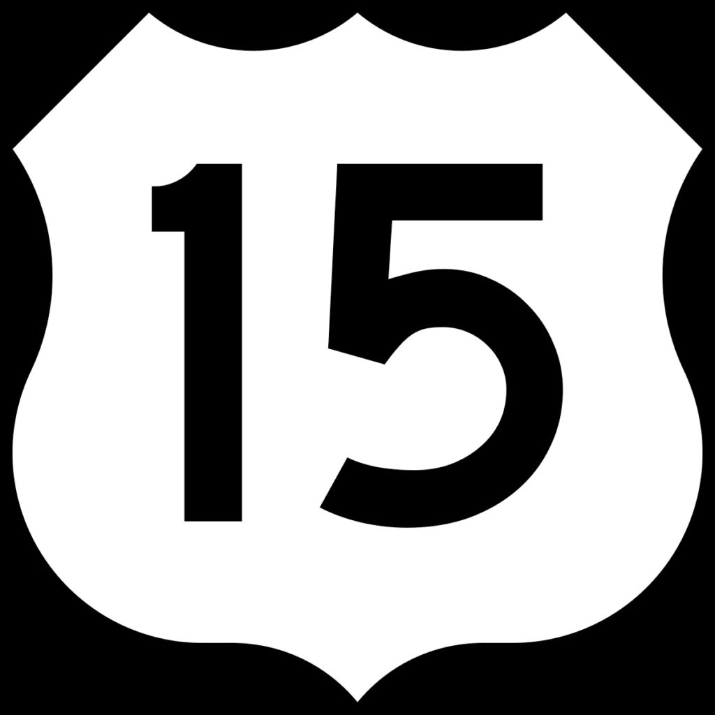
Route 15 Characteristics
Route 15 south out of Frederick, Maryland is primarily a four-lane highway. It is a major north-south corridor that connects various cities and towns along its route. The portion of Route 15 near Frederick is typically a divided highway with two lanes in each direction, allowing for smoother and faster travel. This configuration continues as you proceed south through parts of Maryland and into Virginia.
However, it’s important to note that there are sections of Route 15 where the road transitions into a two-lane byway, particularly as you approach smaller towns or rural areas. In such areas, the road narrows to one lane in each direction, accommodating slower speeds and local traffic.
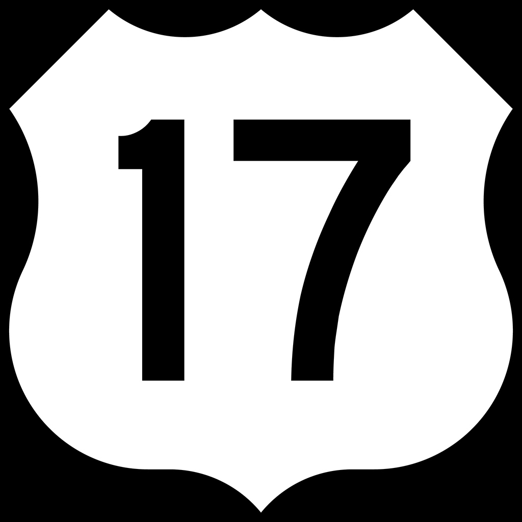
Route 17 Characteristics
Route 17 in Virginia, specifically the stretch from Bealeton, VA to Fredericksburg, VA is primarily a two-lane highway. This portion of Route 17 is known for its scenic and rural character, passing through picturesque countryside and small towns. The road typically consists of one lane in each direction, allowing for a more relaxed and leisurely driving experience.
There are sections along this route where additional lanes are present to accommodate turning lanes or passing zones. Nevertheless, the general nature of Route 17 from Bealeton to Fredericksburg is characterized by a two-lane road that offers a slower pace, rural charm, and an opportunity to take in the scenic beauty of the Virginia countryside.
Fredericksburg For Lunch
I caved into my hunger at about 1:00PM just as I was passing I-95 in Fredericksburg, VA.I stopped at one of those national chain restaurants for a predictably average meal, then crossed over the Interstate back onto Route 17 continuing east.I thought nothing of the dwindling supply of fuel in my gas tank as there appeared to be four gas stations on every corner in Fredericksburg.
That kind of urban environment ended very quickly a few miles out of Fredericksburg onto The Northern Neck of Virginia. I started to worry about the complete absence of ANY gas stations as I continued eastward.I finally came across a small family-run gas station/convenience store/fireworks retail outlet in the middle of nowhere and put 3.6 gallons in my four gallon tank.That’s a bit closer than I like to cut it.My reward…the station offered ethanol free 92 octane fuel.Perfect.
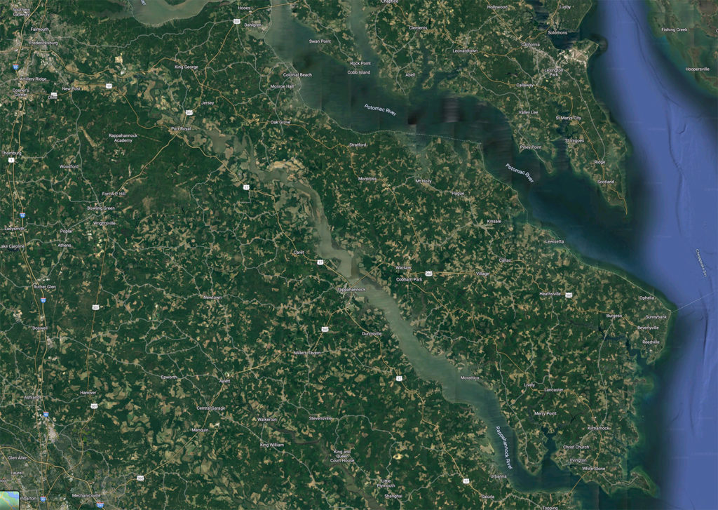
A Google Maps satellite view shows just how rural an area The Northern Neck is
So, What Is The Northern Neck of Virginia?
The Northern Neck of Virginia is a historic and picturesque region located between the Potomac and Rappahannock Rivers, with the Chesapeake Bay to the east. Spanning four counties—Lancaster, Northumberland, Richmond, and Westmoreland—the Northern Neck is rich in history, natural beauty, and a distinct cultural heritage.
Historically, the Northern Neck holds great significance as the birthplace of three American presidents: George Washington, James Madison, and James Monroe. It was also home to notable figures like Robert E. Lee and Richard Henry Lee. The region witnessed pivotal moments during the American Revolution and the Civil War.
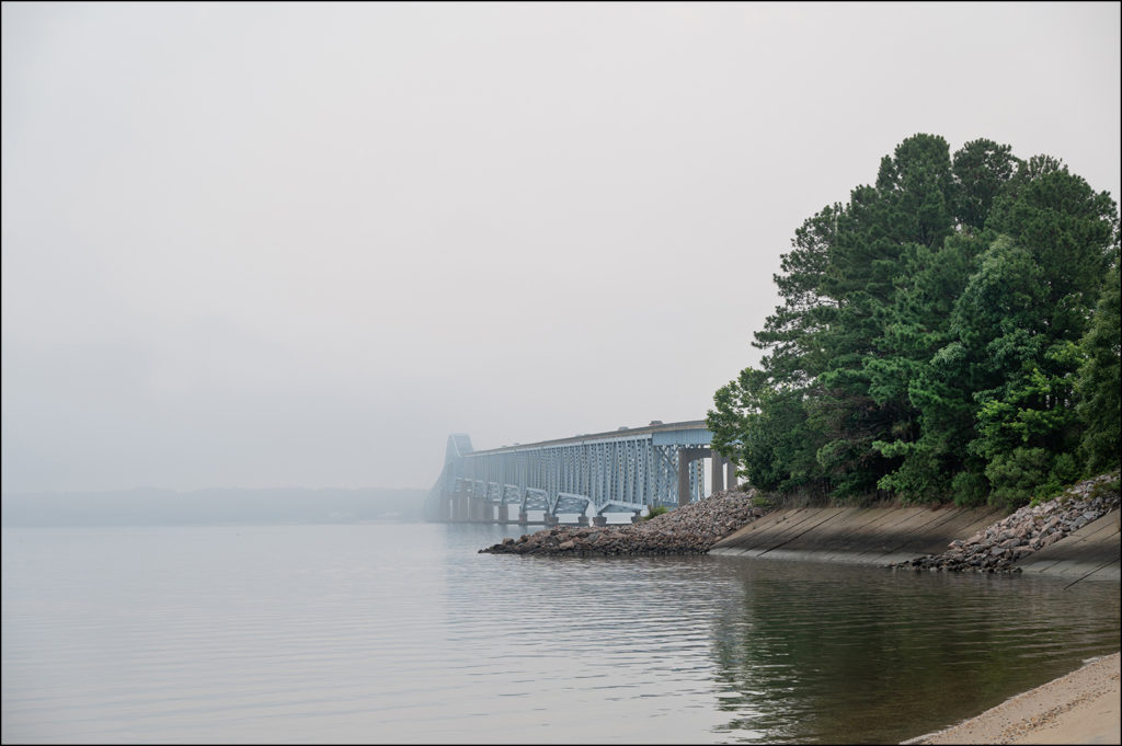
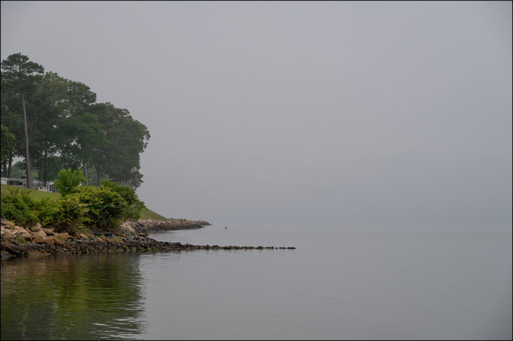
The Robert O. Norris Bridge spanning the smoke bound Rappahannock River
Geographically, the Northern Neck boasts scenic landscapes comprising rolling farmlands, tidal marshes, and waterways. The Chesapeake Bay and its tributaries offer abundant fishing, boating, and water recreation opportunities.
Making A Living • Making A Life
The economy of The Northern Neck of Virginia is primarily driven by agriculture, aquaculture, tourism, and a growing wine industry. Agriculture encompasses farming activities, including corn, soybeans, wheat, and livestock. The region is also renowned for its seafood production, particularly oysters, crabs, and fish.
Commercial fishermen tending to their crab traps in the smoke on The Corrotoman River
Tourism plays a significant role in the economy, attracting visitors to historical landmarks, such as George Washington’s Birthplace National Monument, Stratford Hall (the birthplace of Robert E. Lee), and various colonial-era sites. The Northern Neck’s tranquil beauty, waterfront communities, and local festivals further contribute to its appeal.
Riding On The Northern Neck Of Virginia
I’ve had a twenty year long open invitation to visit a friend who lives on the Northern Neck.I can’t believe that I never took him up on this offer.Ostensibly because it was “out of the way”.It never fit in with my numerous past I-95 interstate burns from New York to Florida.When I wasn’t “slabbing it” south I usually found myself on the opposite side of The Chesapeake Bay, running north or south on The Delmarva Peninsula between Virginia Beach, VA and Lewes, DE.
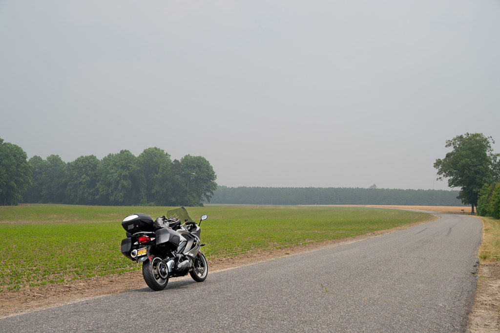
Long sweeping turns through farmland on a smoky Northern Neck
What I witnessed on this first trip came as a total surprise.I was truly overwhelmed by just how rural an area this is.On the map it looks so close to Washington, DC and Richmond, VA.In reality it is an unspoiled paradise of large farms and undeveloped forests.
Riding a motorcycle here is a pleasure.No, you’re not going to encounter highly technical roads with switchback turns and steep elevation changes.But you’re unlikely to encounter any traffic either.You have these beautiful, scenic, rural areas all to yourself.
Living on The Northern Neck Of Virginia
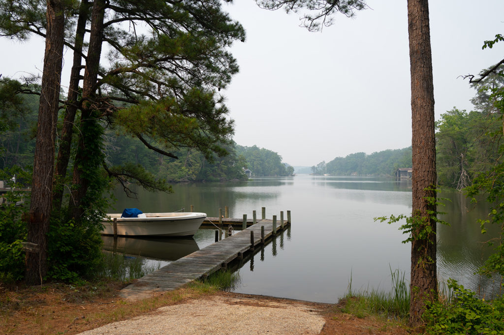
My friend’s modest home is situated on a 6 acre plot of land.His adjoining neighbor’s homesteads are 10 acres and 4 acres respectively.This is the norm in the forested areas on The Northern Neck of Virginia.My friend’s Mom lives just five minutes away in a lovely cottage built right on the Little Wicomico River.This provides a perfect spot for my friend to not only dock his boat (just minutes from The Chesapeake Bay) but also the perfect spot from which to set 1/2 dozen crab traps to harvest those amazing blue claw crabs you’ve heard so much about.
You haven’t lived until you’ve had crab cakes made from crabs that were swimming, captured, cooked and picked less than 24 hours earlier.It didn’t hurt that he used an entire pound of this fresh crab meat to make just five cakes!Yes…they were as delicious as you can imagine.
I’ll Be Back
It took me twenty years to finally get out on The Northern Neck of Virginia on my motorcycle.I guarantee it won’t take me that long to make a return visit.I want to return when the Canadian wildfires are brought under control, and the area isn’t blanketed in the smoke and haze from that natural disaster.Again I find myself apologizing for the rather lackluster photographs that are a byproduct of the contaminated atmosphere.
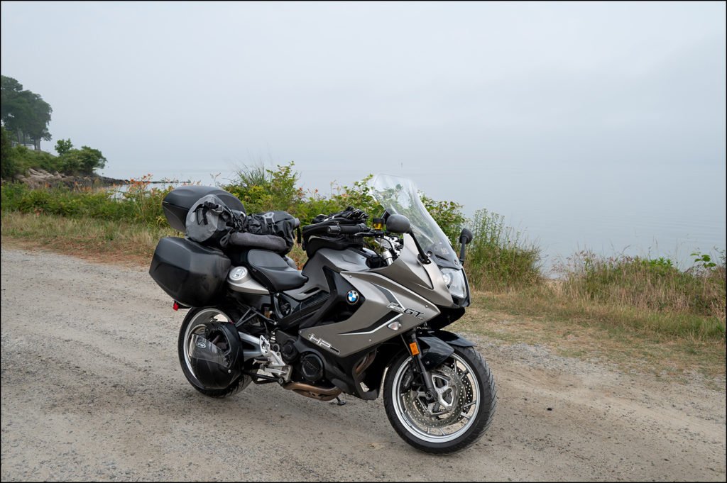
That’s really The Rappahannock River somewhere in the smoke behind my motorcycle
The intricate network of waterways and rivers that surround the Northern Neck of Virginia contributes to its significant waterfront beauty. The Chesapeake Bay, which borders the eastern side of the region, boasts hundreds of miles of shoreline alone.It is estimated that the Neck has over 1,100 miles of total tidal shoreline.I want to get back and capture some of that waterfront beauty with my camera.
Stay Tuned
Up next: The BMW MOA (Motorcycle Owners of America) National Rally in Doswell, VA.Though it’s only 85 miles away according to Google Maps, I have a much longer, backroads route planned along the expansive shoreline of The Northern Neck of Virginia.I hope I get to see some of it through the smoke and haze.
As always we welcome your comments below.Click Here to view an interactive visual index page where you can quickly browse through all of the great features that are published on the Roadcraft USA blog.Be sure to subscribe to Roadcraft USA.We send out monthly email notifications about new features that hit the blog.