RIDING OHIO’S WINDY 9 • PART 1
We’re heading off today for the Windy 9 motorcycle roads in southeast Ohio. As always I find myself leaving my Long Island, NY home at 4:00AM to avoid the horrendous New York City rush hour traffic. It’s September 15th and the nights have gotten noticeably longer. I stop to pick up my buddy, Parag (and his BMW R1250RT). We clear New York’s George Washington Bridge before 5:30AM with sunrise still an hour away. A 600 mile interstate burn lies ahead of us. Three other friends departed yesterday and are already enjoying the roads that are waiting for us in The Buckeye State.
The Windy 9 motorcycle roads in Ohio are a renowned two-wheeler’s destination, offering a thrilling and scenic riding experience for enthusiasts. These roads are located in the southeastern part of the state, known for its rolling hills and picturesque landscapes. Riders can expect to be surrounded by lush forests, charming small towns, and stunning vistas. It’s a visual treat, as well as a dream motorcycling destination. The roads, that are aptly named for their winding and twisty nature, also feature constant elevation changes; adding to the roller coaster type effect of riding in this region.
Official FYI Resources
Any motorcyclist planning a trip to the Windy 9 motorcycle roads is encouraged to visit the official website maintained by The Athens County Convention and Visitors Bureau. This very well designed site allows you to view a detailed, color-coded map showing the hundreds of miles of roads that make up “The Windy 9”. You may want to open the map in your browser right now. It will give you a much better idea of the locations, the scenes and the roads we chose to ride upon to access them.
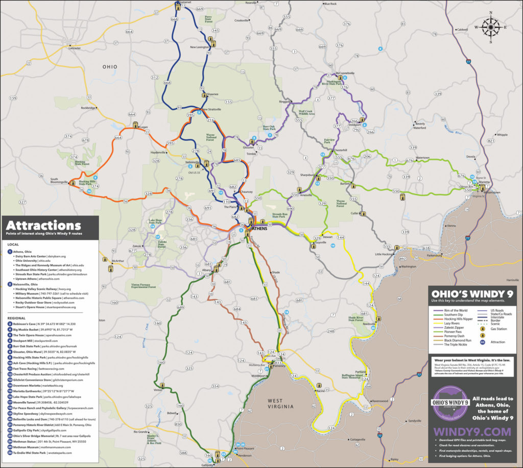
Furthermore; each of the nine routes that make up the Windy 9 can be viewed on the site individually. Both the main map and the individual maps are downloadable as PDF files. Better still: Click the “Map Request” link on the site and you’ll receive a printed map in the mail in just a few days…completely free of charge. I highly recommend you take advantage of this perk. You, and your riding companions, will spend a lot of time looking over the printed version of the roads and recommended routes while you’re riding in the area…regardless of what you use for navigation onboard.
Breakfast and a Bottleneck
First thing Saturday morning the rest of our group arrived at our hotel in Athens, Ohio. The Windy 9 motorcycle roads are all centered around Athens, a city of 25,000 people located on the Hocking River. It is home to Ohio University; a large public research institution with an undergraduate and graduate enrollment of more than 21,000 students. We would encounter a great number of them shortly.
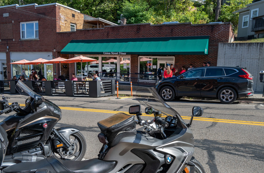
But first…breakfast. We chose the Union Street Diner at 70 W Union Street in Athens and were not disappointed. Good food. Good service. Good prices. Parking was plentiful on the street in front of the establishment; though it did involve feeding a few quarters into the meter to keep the parking disciplinarians at bay.
After breakfast we headed south towards one of the Windy 9 motorcycle roads known as “The Pomeroy Dash”. The ‘dash’ part didn’t start as soon as planned. Apparently a large sporting event was taking place on the Ohio University campus today. We waited at a traffic signal, watching it cycle from green to red at least 15 times, while what seemed like ALL of those 21,000 students were safely ushered across the intersection in front of us by law enforcement.
The Pomeroy Dash
The Pomeroy Dash is #7 of the Windy 9 motorcycle roads. It heads south out of Athens on Old Route 33 and provided a nice taste of what was to come over the next two days. Until it merged with #2, “The Southern Dip” and #4 “Lazy Rivers”. At this point all three of those Windy 9 motorcycle roads become anything but windy. They all include an eleven mile long stretch of Route 33, a four lane divided highway!
We bailed out on the four lane in the town of Pomeroy and once again picked up “The Pomeroy Dash”; now on Route 143 heading northwest. I can’t honestly report on the remaining part of “The Southern Dip”, but it is clearly one of the least challenging roads in the area; whether you’re just looking at the map or slogging along on the four lane.
The Zaleski Zipper
In the town of Albany we picked up route 50 heading west. This is part of the Windy 9 route #5, “The Zaleski Zipper”. This wonderful road transitions into Route 278 North and takes you through the Zaleski State Forest. You’ll pass Lake Hope State Park along this stretch of road.
At this point you’re starting to enter the forested region of Ohio that is marked by steep gorges and narrow ridges. ADV riders should take note: The Ohio Department of Natural Resources offers various camping options from cabin rentals to improved campgrounds to primitive camping. Visit their website to see all of the options.
Hocking Hills
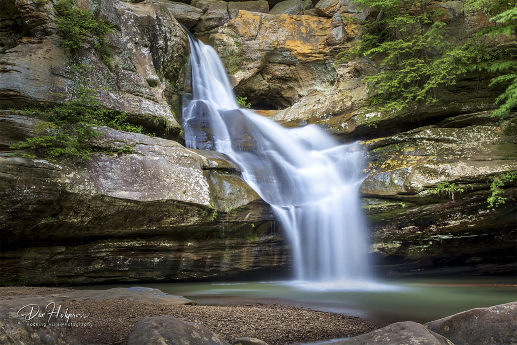
Cedar Falls: The most photographed waterfall in Ohio with its water plunging 50 feet
At Ohio State Route 56 we turned west and headed towards the Hocking Hills region. This area is Ohio’s premiere outdoor adventure destination. More than 10,000 acres of unbroken forests surround Hocking Hills State Park; home to some of the most beautiful waterfalls one will ever lay eyes upon. Two problems arose…
Problem #1: 2023 was one of the driest years on record in the region. As such, the volume of water that normally passes over the falls in the park was reduced to a trickle. During the planning stages of this trip it had been my intention to photograph some of the beautiful scenery in Hocking Hills State Park. I contacted a local photographer that I have come to know through the miracle of social media channels. He informed me of the region’s drought and magnanimously offered to provide some of his own stunning imagery to accompany this feature. The name of this talented photographer is Don Holycross and you will see his watermark on these images. For those who are interested in Don’s imagery, select prints are available at Home Grown on Main, 65 West Main Street in Logan, Ohio. You can also contact the artist via his website at Hocking-Hills-Photography.com.
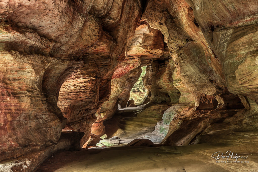
The Rock House: A 200 foot long, 25 foot high cave in Hocking Hills State Park
Problem #2: The day we chose to ride to Hocking Hills State Park turned out to be the date of the 45th Annual Hocking Hills Trail Run. The Hocking Hills Trail Run winds through vast wooded areas of the Hocking Hills State Park and Hocking State Forest, crossing streams and deep gorges in the dense lush forest. A 60k run (37.28 miles) starts at 7 a.m. A 40k run (24.85 miles) starts at 8 a.m. Other races (5k, 10k and 20k) start between 9 and 11 a.m. Guess where they all end? Yep…right in Hocking Hills State Park. There were literally thousands upon thousands of visitors at the park when we arrived. I couldn’t have gotten a good picture of the waterfalls even if the water was flowing. Heck…we couldn’t even find parking spots to squeeze the bikes into.
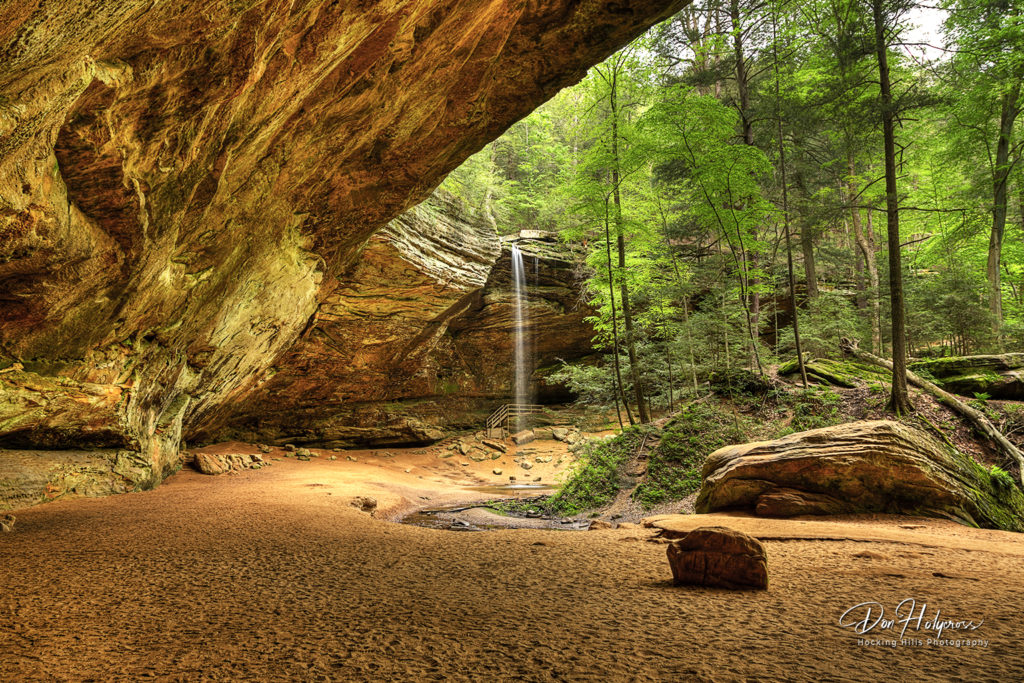
Ash Cave: The largest recess cave east of the Mississippi
Do As I Say…Not As I’ve Done
Hocking Hills State Park is a gem, for sure. Go early in the season when the winter’s snow melt and spring’s showers have the waterfalls flowing in all their glory. Check the park’s calendar before you plan your visit. You definitely don’t want to show up on the day of the annual trail run.
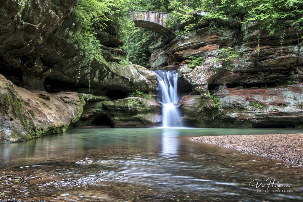
The Upper Falls at Hocking Hills State Park
The Skies Above
Just west of Hocking Hills State Park on Route 664 you will find The John Glenn Astronomy Park. The venue is located in one of the few remaining areas of Ohio where the night sky can be seen in all of its splendor. I knew that I would be arriving in Athens on the night of the new moon…the darkest night of every month, and the best night for viewing the night sky. Furthermore…conditions were ideal that night. Perfectly clear skies without a cloud for a hundred miles in any direction.
I also knew that I had been awake since 4AM and had two full days of demanding riding ahead of me on those Windy 9 motorcycle roads. The prospect of pulling an ‘all-nighter’ before two full days of technical riding didn’t make sense on any level. Once again I defer to the artistry of Don Holycross with this incredible image of what you could experience if you plan your visit with a little more free time built in to your schedule than I did.
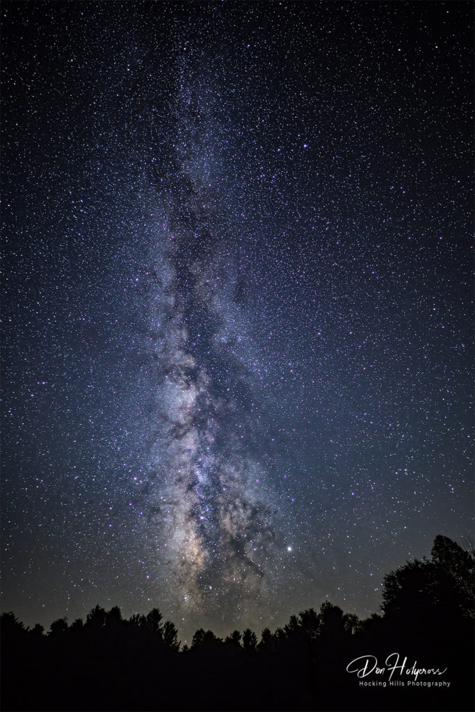
Artist’s Rendezvous
The next segment of today’s ride would take us through Logan, Ohio. While the rest of my group wandered around town a bit I went to meet my photographer friend, Don Holycross, in person. By prior arrangement we had agreed to meet at The Bowen House; an art gallery where some of his works were currently hanging on display in a photography exhibit.
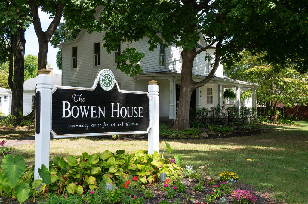
Quoting from The Bowen House website:
“Built in 1831 and nestled in a historic neighborhood of Logan, Ohio, The Bowen House is a nonprofit center for cultural arts and special events. The mission of The Bowen House is to provide the Hocking Hills region and southeastern Ohio with opportunities for diverse cultural enrichment, positive social activities, and a commitment to historic preservation. Today, leased by the First Presbyterian Church, The Bowen House serves as the community’s primary arts center which promotes Hocking Hills-area art, artisans, and culture.”
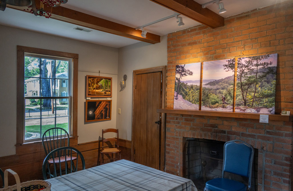
Don and I spent some quality time together discussing all things photography-related. Another photographic artist I know from the area, Renee Williams, was recovering from a bout with COVID and couldn’t join us. Her husband, Mike, gladly took care of the social obligations and put in an appearance on her behalf. In true welcoming fashion he arrived at The Bowen House on his new BMW R1250 GS motorcycle. Motorcyclists will do anything as an excuse to ride…even if it means visiting an art gallery on a sunny Saturday afternoon. If local art and culture interest you The Bowen House should be on your list of places to stop. Be sure to check ahead of your visit for their limited exhibition hours.
Lunch In Logan
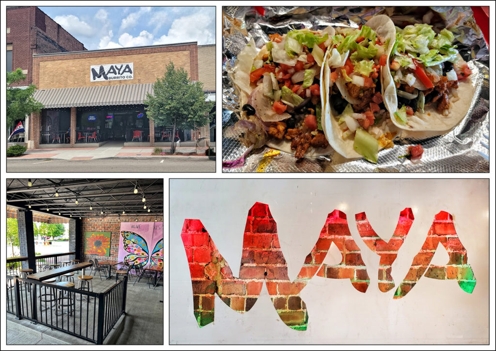
The “Ride To Eat Motorcycle Club” was starting to get a little ‘hangry’ at this point in the day. A quick Google search turned up a couple of interesting prospects right here in Logan so we rolled down to the center of town. First stop was Maya Burrito Co. at 12 E. Main Street. The other guys in my group said the Mexican fare was quite good. (I was saving my appetite for dessert). We enjoyed their offerings on the outdoor veranda overlooking the Main Street sidewalk.
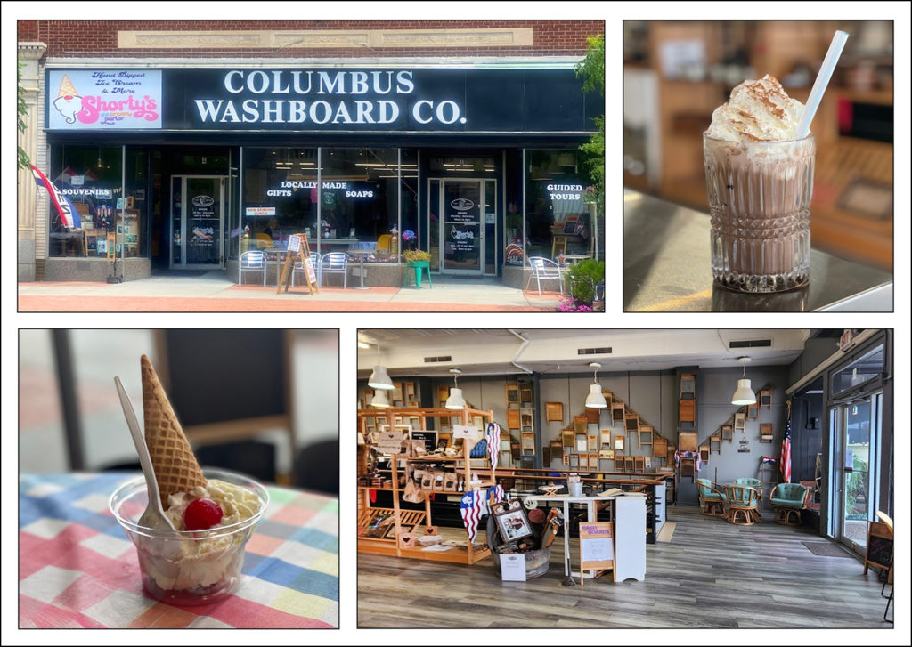
For dessert we walked right next door to Shorty’s Ice Cream Parlor; located within the storefront of The Columbus Washboard Co. In addition to serving up some fine frosty treats, the shop offers locally-made/locally-sourced gifts and souvenirs…not the least of which were washboards of all shapes and sizes. Now I’m no expert on washboards but I would guess, by looking around the shop, that their inventory is fairly extensive.
Unplanned Adventure
Fully refreshed and still staring a beautiful, sunny 75 degree day in the face; we decided to extend the day’s ride. We opened up the hard copy of the Windy 9 motorcycle roads map (Send for your copy…I’m not kidding). We decided we would traverse the lower portion of route #8, the “Black Diamond”. Some quick entries were made into the bike’s GPS unit and off we went. I needed fuel at this point so the first waypoint was set for a gas station in Shawnee, Ohio; approximately 15 miles north.
Anyone who has read my book, “Road Work: Images and Insights of a Modern Day Explorer” knows that I have affectionately named my GPS unit “Dumbo”. You see, it doesn’t always make the most sensible decisions. Today would be one of those times. As near as I can figure (and I’m being far too understanding of the navigator’s shortcomings) Dumbo decided that I shouldn’t have to make a left hand turn across a double yellow line to enter the gas station 15 miles up the road.
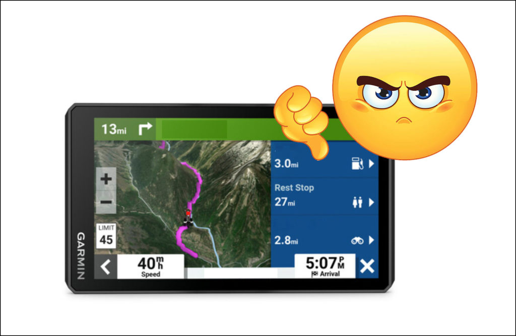
Instead Dumbo chose to lead us down some smaller roads that would meet the same fuel stop from a spot a little further north…thereby allowing me to negotiate a much safer right hand turn into the service station. Sadly this route meant traversing about 10 miles of unpaved, rock and boulder-strewn hell. Now Frank, aboard his brand new Ducati Multistrada, was well-equipped for this detour. My mid weight sport-touring bike with less than 5 inches of suspension travel was not so eager. Roman had the daunting task of tackling this undeveloped terrain on a Honda Goldwing.
What’s Ahead?
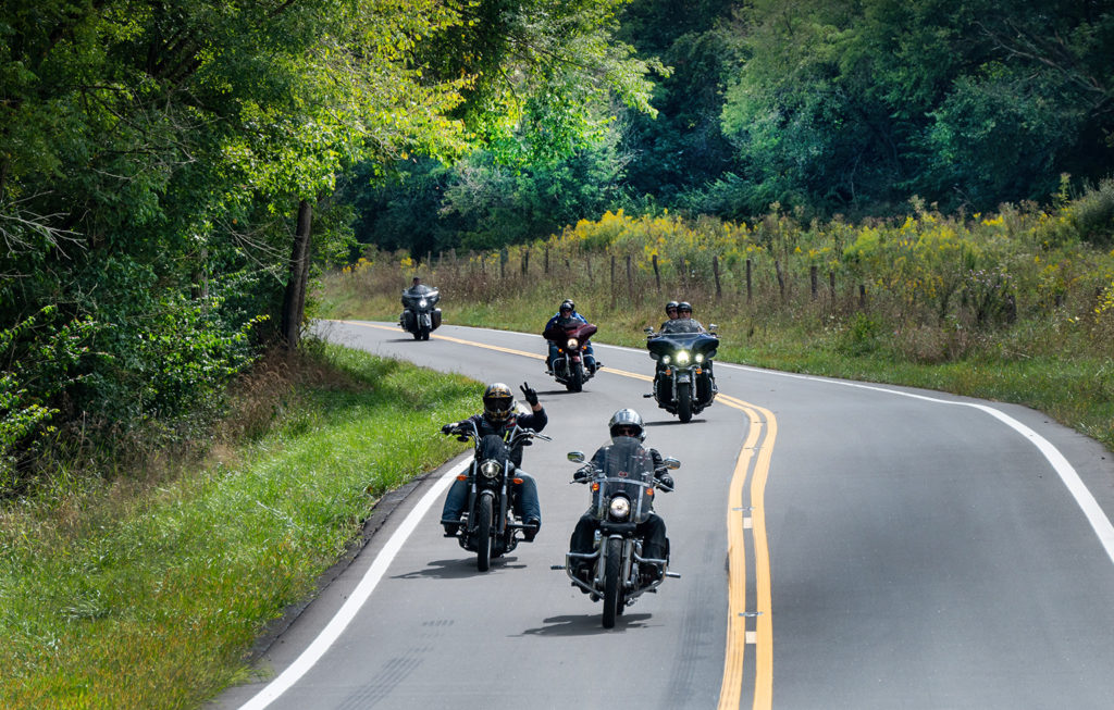
We all made it through upright and unscathed, but Dumbo’s senseless decision cost us at least an hour of quality riding time. Now I know some of you ADV types would have considered this quality riding time. Me? Not so much. I topped off my fuel tank and we made a decision to call it a day and head for the barn. We were still an hour out of Athens via a southern section of the #8 “Black Diamond” ride (Routes 216, 78, 685, 13 and 682). It was a wonderful series of roads to end the day on.
Tomorrow morning our plans are to take on some of the most technically-challenging parts of the Windy 9 motorcycle roads, including the infamous Route 555 – “The Triple Nickel”. The weather wizards aren’t being too optimistic; telling us that Mother Nature might have other plans in store for us. We’ll tell you how it all turned out in the next blog post.
As always we welcome your comments below. Click Here to view an interactive visual index page where you can quickly browse through all of the great features that are published on the Roadcraft USA blog. If you like this resource please support it by sharing it with all of your friends and family. Be sure to subscribe to Roadcraft USA. We send out monthly email notifications about new features that have dropped on the blog.

Michael what a Great Story, your Description of Events is so Detailed it keeps you wanting more of the ride. Look Forward to read Part 2 of this Trip. Wonderful Job.
Thanks, Buddy. Part two will be published later this week.